Educational trail “Gregoty Gorgan”
-
Distance
9 km -
Duration
5 hours
-
Office of the Gorgany Environmental Research Unit
The trip to the protected area starts from the office of the Gorgany Environmental Research Unit. We set off accompanied by an employee of the reserve.
-
Beginning of the reserve
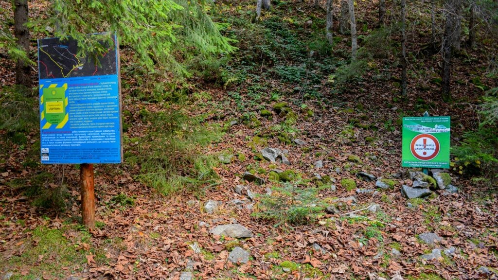
After walking a kilometer and a half from the beginning of the route, we find ourselves in the Gorgany Nature Reserve. On stony soil we can spot the fire salamander (Salamandra salamandra), for which nature has created the best conditions here. We need to go further along a dirt road. In a few minutes we will see the kingdom of mosses growing in the forest stand between tall slender spruces and their undergrowth. Forest vegetation covers more than 85% of the reserve area.
-
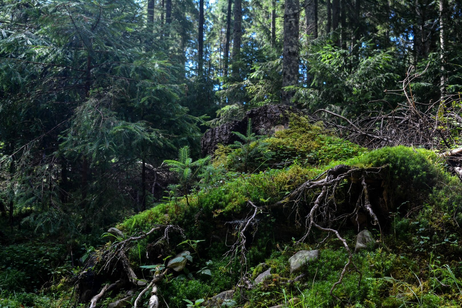
Kingdom of mosses (Bryophyta) and clubmosses (Lycopodium)

Having walked 520 metres more, we stop among the mosses. 231 species of these plants grow on the territory of the reserve. 50 metres further from the kingdom of mosses (Bryophyta), we get into the kingdom of clubmosses (Lycopodium). It is an evergreen herbaceous plant that is often found in coniferous and mixed forests. Several ascents and descents – and the trail brings us to a well-equipped stop with a bench, where you can take a rest.
-
Well
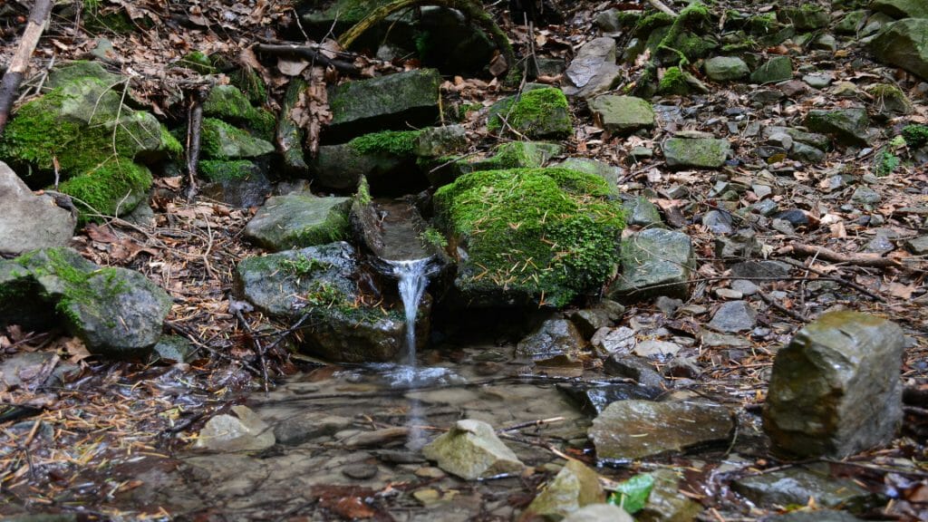
3 kilometres from the beginning of the route, among the spruces and blackberry thickets, one can gain strength by tasting spring water from a well. There are many springs in the territory of the reserve, from which about 30 streams originate.
Our route goes to the left of the well along a trail that runs across the slope. We are entering the primeval beech-fir-spruce forest. On both sides of the trail we are accompanied by age-old trees shading the ground from the sun rays, so there is no herbaceous vegetation here, only toothworts (Cardamine) and the common comfrey (Symphytum officinale) appear occasionally, as well as moss on the stones. The trail leads up through the thickets of blueberries and cranberries to the stone runs. Local name: gorgany, gregoty, senety. -
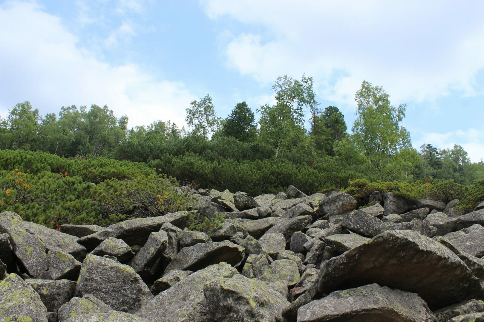
Stone rivers
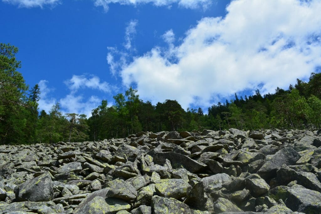
Having walked 1,110 m more, stone “rivers” – gregoty – open before us. The stone runs of the Gorgany Nature Reserve consist of sandstones that are almost resistant to weathering process, and therefore have remained deforested since the last glacial period. They occupy over 11% of the total area of the reserve. The width of the runs in this area is 100 metres. The stones are covered with yellow lichen. To the left, panorama of the Yavirchyk, the Taupyshirka, the Dovhyi Hrun ranges and Parok montane meadow is revealed. The Scots pine (Pinus sylvestris), the relict Scots pine (Pinus sylvestris), the European cedar pine (Pinus cembra), the dwarf mountain pine (Pinus mugo), the birch (Bétula), the crowberry (Empetrum nigrum), the blueberry (Vaccinium myrtillus), the lingonberry (Vaccinium vitis-idaea) grow on the runs. On the border with the stone runs we can observe an interesting phenomenon of nature: the spruce is struggling to survive in extreme conditions – on rocky soil. Here, the tree, which we usually see over 30 metres high, grows low, although the trunk is quite thick. The lower branches spread over the stones and form a dense lizhnyk rug, which sometimes covers an area of 20-25 square metres. Then we enter the spruce forest.
-
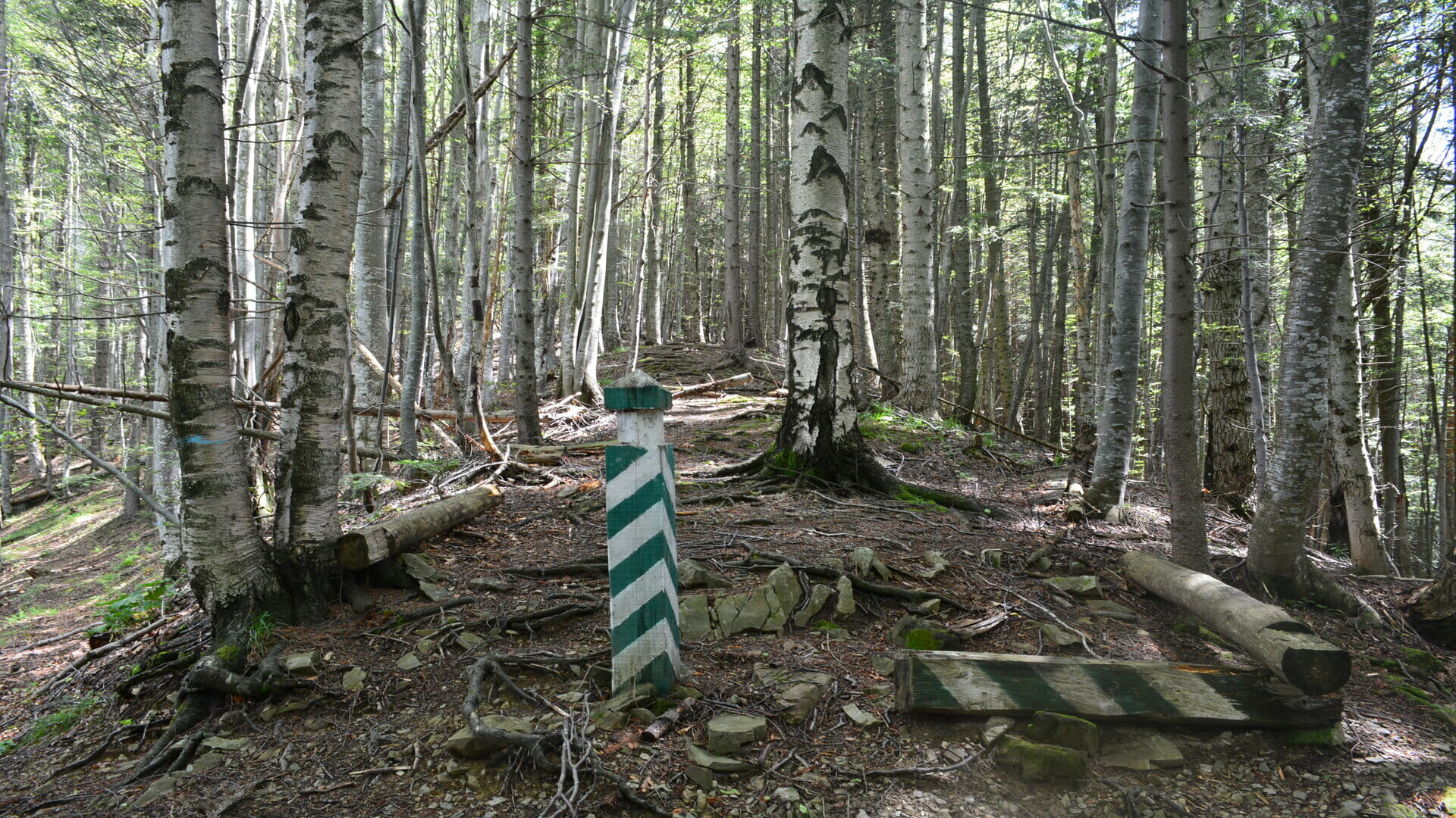
Way to Mount Berezovachka
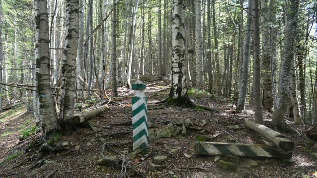
The next stop is near the distance post between quarters 12, 13, 14 and 15 of the Gorgany Environmental Research Unit. To the right, the trail leads to Mount Berezovachka. We are at the highest point of the route – 1,080 metres above sea level. From the north-western side we see spruces, firs, beeches, birches. The soil contains a small number of stones. From the north, the beech stand is located. Then we turn left. The rocky path wriggles like a snake amidst fir and spruce trees that are 90 to 150 years old. 155 metres left behind, old-timer trees are replaced by very young ones. The stoniness of the soil has increased. The soil is covered with green moss. Behind them, dense thickets of blueberries are seen along the trail, and even above the trail there are gray-blue mosses. In a while we enter the thickets of mountain pine (Pinus mugo). It grows in a narrow strip up and down. The height of plants near the forest is 3 metres, and near stone runs – from 0.5 metres. A difficult path through the thickets of mountain pine is yet to be followed.
-
Stone field

750 metres further and we will see a large stone field. The width of these runs on the route is 125 metres. They spread up to 300 metres on the slope upwards, and up to 600 metres downwards. Occasionally, the mountain pine (Pinus mugo) grow on stone runs in groups, the birch (Bétula) and spruce (Picea) grow as single trees. The European cedar pine (Pinus cembra) may be also sometimes found.
Following the route across the slope from southwest to northeast, we can see stones from 20 to 150 cm in size, covered with crustose lichens, mostly yellow or red occasionally. We come back to stop 5, following the same trail, and from there a steep trail leads down to stop 7. -
Feed rack for animals
270 metres more are left behind and we are getting to the place where a feed rack for feeding wild animals in winter used to be located. Deer and roe deer are still coming to this place. A total of 1,278 animal species live on the territory of the reserve, 55 of them are listed in the Red Book of Ukraine, namely: the wildcat (Felis silvestris), the lynx (Lynx lynx), the smooth snake (Coronella austriaca), the black stork (Ciconia nigra), the capercaillie (Tetrao urogallus), the common crane (Grus grus), the eagle-owl (Bubo bubo), the common otter (Lutra lutra) and the badger (Meles meles). In winter, animals can feed on the Perenyz meadow for which our route heads.
-
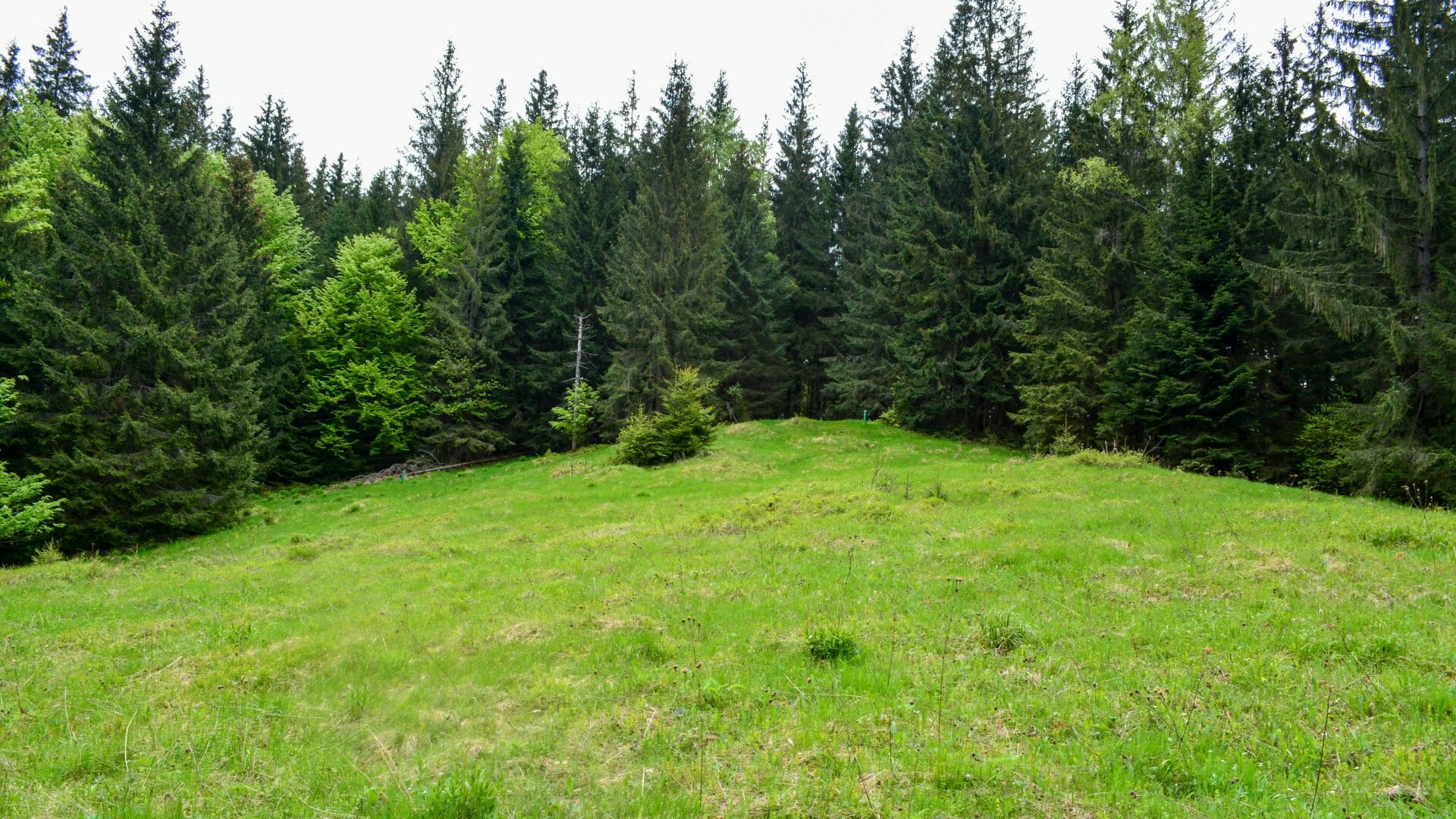
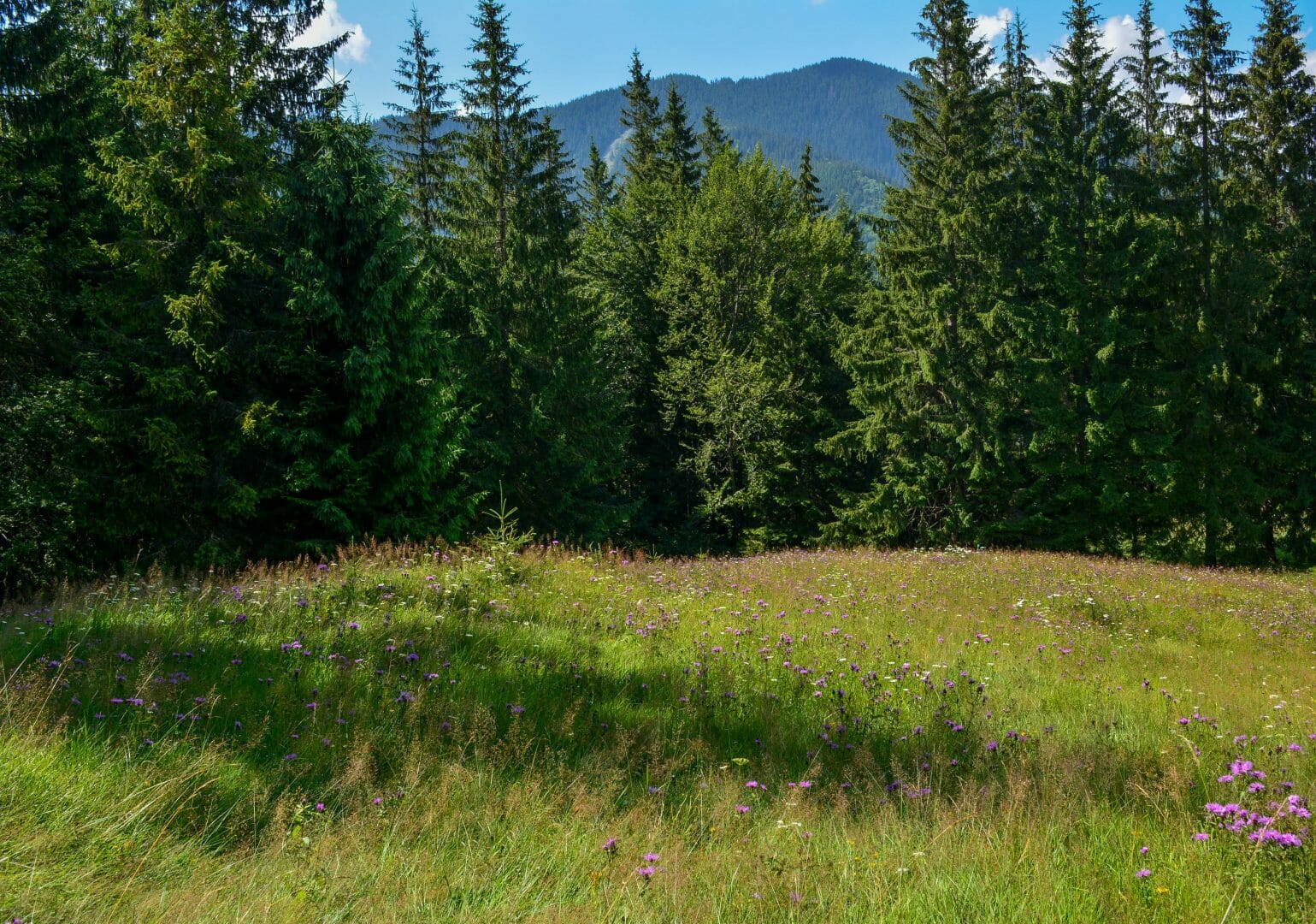
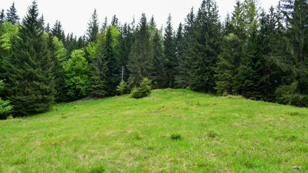
Perenyz meadow
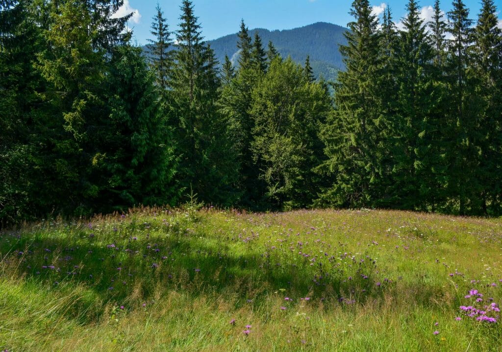
The flowers on the meadow bloom from spring to autumn. Here you can find 5 species of orchids (Orchidaceae), the snowdrop (Galanthus), Arnica, the autumn gentian (Gentianella amarelle), the feverfew (Tanacetum parthenium), the willow gentian (Gentiana asclepiadea), the globeflower (Trollius europaeus), Centaurea kotschyana and other plants. Amidst the mixed herbs, the common juniper (Juniperus communis) grows singly. To date, 35 species of vascular plants listed in the Red Book of Ukraine have been found in the reserve. And this is more than 20% of the total number of “Red Book” species growing in the Ukrainian Carpathians.
Then we are practically running down a steep path, because the downhill slope does not give a chance to stop. Tall spruces grow everywhere around. Rocky soil lies under our feet. We are going down the trail, and so we are met by beeches and spruces, which are further replaced by birch thickets on the right side. The trail leads us to a stocky beech. -
Giant beech
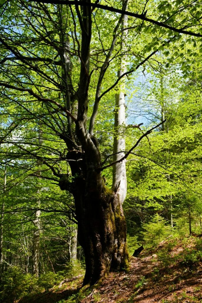
A giant beech stands on our way. As many as 12 trees have grown into a single trunk. Its circumference is 4 m 56 cm. We turn right, go down a rocky path. On the right, sparse spruce forest and hazel bushes can be seen. Here, the population of a relict plant – the perennial honesty (Lunaria rediviva) and rare liana – Atragene alpina was identified. Different species of ferns (Polypodiophyta) can be found in the grass canopy. Wetlands are located below. Such conditions are favorable for the growth of the grey alder (Alnus incana). Wetland-dependent species like to grow in alder stands, in particular, the marsh-marigold (Caltha palustris) flowers here in spring. Under conditions of warm autumn we can observe repeated flowering. Having walked a few metres past an artificial lake, reflecting the sky and the tops of trees, we again find ourselves captivated by spruce undergrowth and carpet of blueberry bushes and blackberry thickets.
-
End of the route
You can already hear the noise of the fast-moving mountain river Bystrytsia Nadvirnianska, on the banks of which tall beeches and spruces grow. After crossing the bridge, we stop at the office of the Gorgany Environmental Research Unit, where our journey through the gregoty of the Gorgany began.
Deviation from the route.
Damage to natural objects.
Breeding hearths in places not designated for this purpose, smoking when passing through forests.
Felling and damage to trees plucking flowers, collecting medicinal plants.
Hunting for animals, destruction of their habitats.
Catching fish by any means.
Stay with firearms.
Territory littering, noise.
Report to the Ministry of Emergencies before you go on a hike, so that rescuers can find you quickly and in time if something happens. This requires only two steps:
-
Fill out the online form
Fill in the online form to inform the mountain search and rescue units about the planned trips to the mountains.
Online form -
Save the contacts of rescue units
Make a note in your mobile phones of the mountain search and rescue units of the area in which you are going to travel.
Contacts of divisions